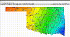
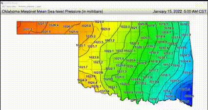
First off, here's the video of the measurements.
The ripples caused by the eruption are radiating from the North-West.
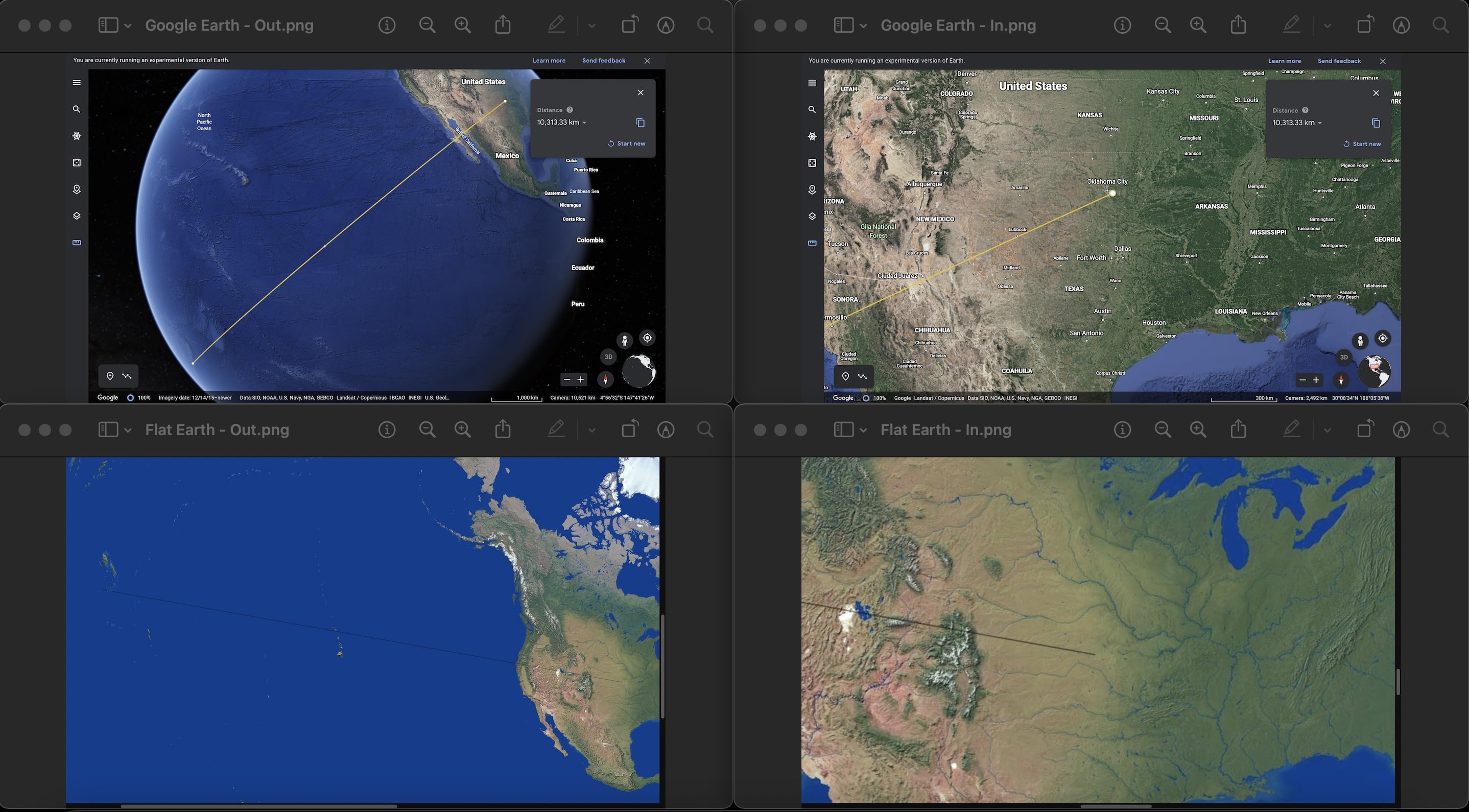
I have connected both Tonga and Oklahoma with a line in both Google Earth and on a Flat Earth map.
I have rotated the Flat Earth map by 15 degrees to make the US align on both maps.
Looking at the trajectory of the line on Google Earth shows the line coming in from the South-West.
Looking at the trajectory of the line on Flat Earth map shows the line coming in from the North-West.
I will make another post of the screenshot of both maps zoomed in and out with the line between the two places.
Top left: Google Earth - Zoomed out.
Top right: Google Earth - Zoomed in.
Bottom left: Flat Earth map - Zoomed out.
Bottom right: Flat Earth map - Zoomed in.
